Analysis of 1838 Tithe Award Map Transcript for the Parish of Wivenhoe
Who Owned What of the Itemised Plots of Land and Who Were the Occupiers?
Pat Marsden


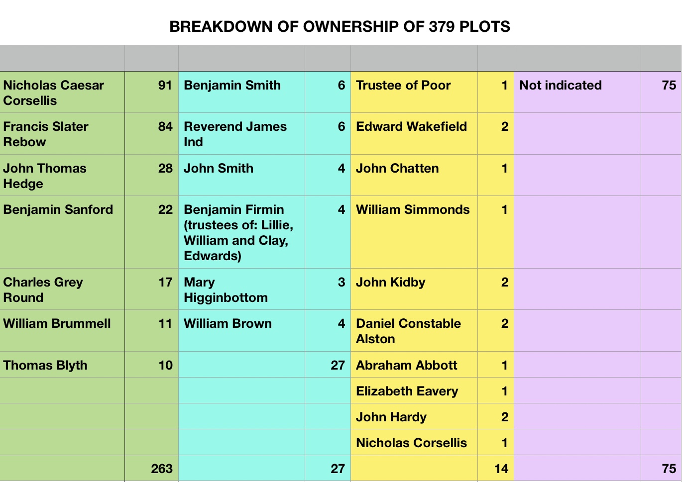
Essex Record Office holds a copy of the 1838 Tithe Award Map for the Parish of Wivenhoe D/CT 406B. This is accompanied by a Key to the Map D/CT 406A which lists all the 379 Plots in plot order. The key cites 371 plots but there are 8 additional plots marked a which brings the total to 379 not including the roads and part of the river.
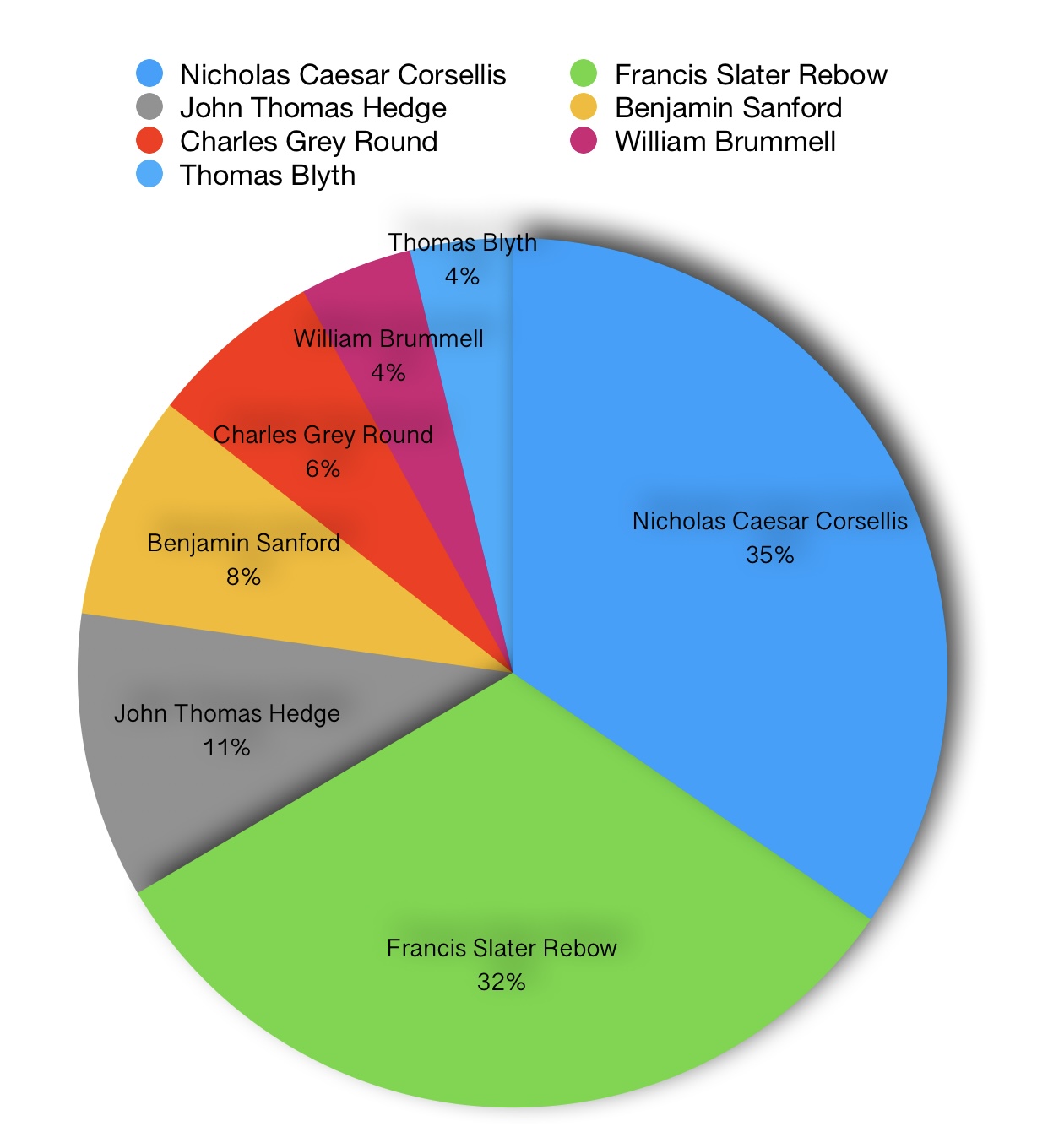
263 of the plots were owned by a small number of landholders. These were Nicholas Caesar Corsellis (91 plots), Francis Slater Rebow (84 plots), John Thomas Hedge (28), Benjamin Sanford (22), Charles Grey Round (17), William Brummell (11) and Thomas Blyth (10).
A surprisingly large number of plots (75) had no details of ownership indicated. 27 plots were owned by people who owned 3-6 plots of land and 14 were owned by people who only owned 1-2 parcels of land.
To view the complete analysis with details of who occupied each plot click on the download below. The original transcript D/CT 406A also includes a name or description of each plot and its actual size but that information has not been included in this particular analysis.
Note: for information about the Tithe Survey following The 1836 Tithe Commutation Act visit the National Archives


No Comments
Add a comment about this page