Deeds Referring to Land Owned by John Thomas including Old Hall, Cold Hall and the Underset to the Cross Keys Tavern 1728-1813
Part of a bundle of 32 Documents held at Essex Record Office D/DEl T379
Added by Pat Marsden


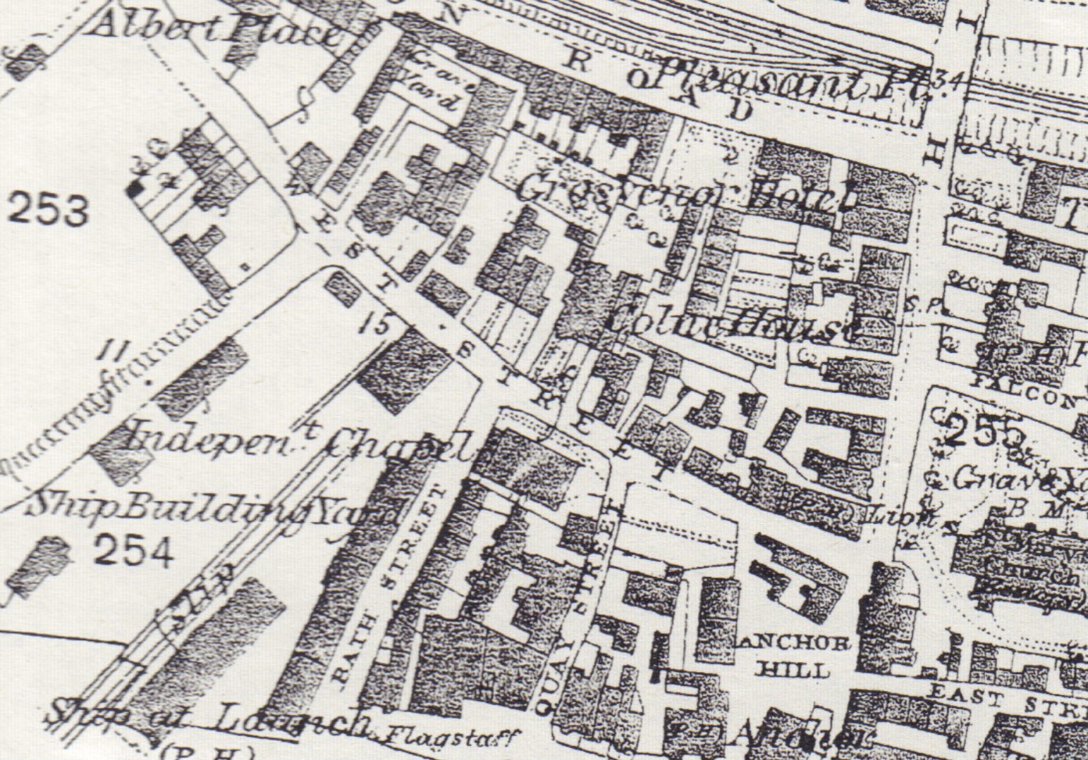
While transcribing various collections of deeds in the last few years we frequently came across references to three particular parcels of land in lower Wivenhoe situated both to the west and the east of the lower High Street. These were called Old Hall and Cold Hall (to the west) either on or off what was originally called Hog Lane and is now West Street (opposite the church as indicated on the 1838 Tithe Award Map), and the Undersett to the Cross Keys Tavern (to the east) running south from just below what is now Queens Rd towards the Falcoln and East Street, as shown (but not named) on the 1799 Survey Map of Wivenhoe.
We’d seen all or some of these three properties referred to in the deeds of the Havens family (1866), the north side of East Street (1866-1919), and in the Will of John Thomas (1809-13) who, although he was described as a Farmer in the earliest deeds, had gravitated towards naming himself as a Yeoman of Wivenhoe by the early nineteenth century (see downloads below).
Following a search in Essex Record Office we came across a bundle of 32 documents (D/DEl T379) dated 1761-1860 which appeared to contain additional material which would shed light on these three properties. We obtained digital copies of the earliest material and the deeds listed below comprise the first nine transcribed deeds of the complete bundle which relate mainly to these and other properties held by John Thomas from 1788 – 1813.
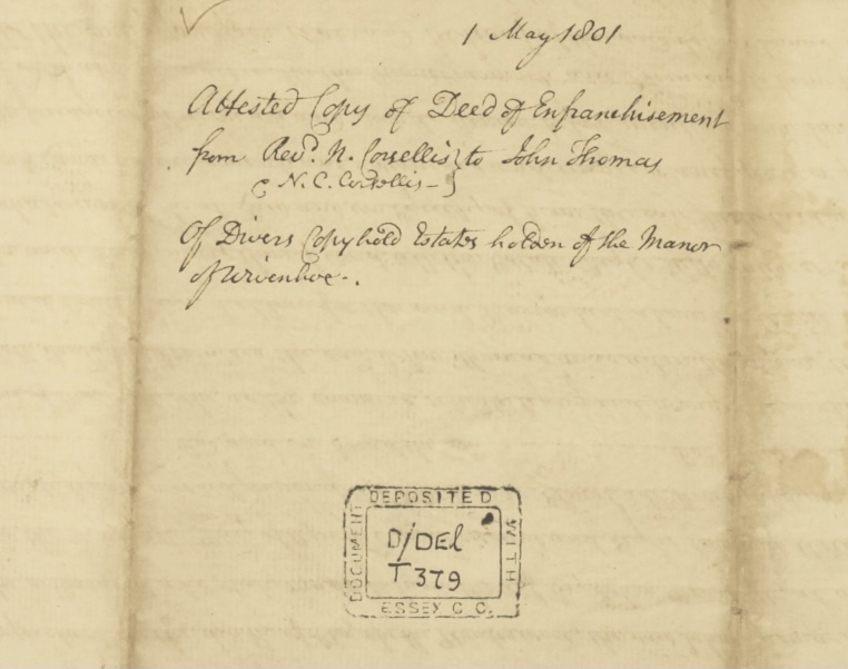
Although most of these early deeds refer specifically to Old Hall, Cold Hall and/or the Undersett to the Cross Keys Tavern the deed of Enfranchisement of 1801 was particularly interesting because it revealed that John Thomas was either the Copyhold tenant or occupier of many other additional properties held by the Manor of Wivenhoe and most of these were listed on the 1799 Survey Map of Wivenhoe.
It was also interesting to observe the size and extent of these properties confirming John Thomas’s status as a local Farmer and it reminded us that Wivenhoe was not just a maritime town with its emphasis on fishing, shipping and ancillary activities, but also a farming town. Brown in ‘Essex at Work 1700-1813’ (p126) suggests that there might have been even greater agricultural activity in the parish if so much of it had not been take up by ‘genteel houses and their estates’. Even so following the decline of the clothing industry and the demand for wool in the mid-eighteenth century, by 1838, out of the 1,469 acres of tithable land in the parish, 78 per cent was arable and 19 per cent meadow, pasture, and marsh; less than 2 per cent was woodland see.
Ironically the three (more domestic) properties we were most interested in i.e. Old Hall, Cold Hall and the Undersett to the Cross Keys Tavern, all in the lower part of the town, were not listed on the 1799 Survey Map although they were listed on the Deed of Enfranchisement.
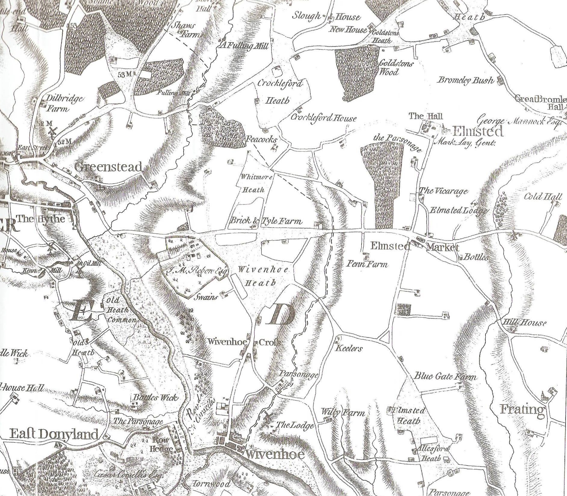
Most of the other properties occupied by John Thomas which were shown on the 1799 Survey Map were situated to the north of the parish in the vicinity of the road leading to Elmstead Market.
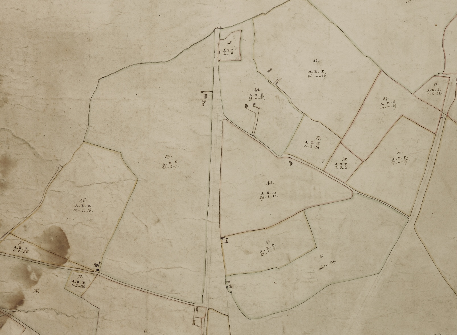
One such was Parcel Q (66 acres 2 rods and 14 perches) and Parcel AA (2 rods and 10 perches) of Frithy Wood Land which lay to the east of Colchester Road approximately where today’s Vine Farm Estate lies. The Victoria County History of Essex Vol. X (p284) refers to the fact that timber had been regularly sold from this wood in the seventeenth century.
Frithy Wood Land was not included in the Deed of Enfranchisement but since it was part of ‘The Lords Demesnes’ it may possibly have been disposed of shortly before this or been occupied by another tenant,
John Thomas also occupied a freehold property called Choises (Parcel 59 on the 1799 Survey Map) comprising 84 acres 2 rods and 7 perches which appears to have been on or near to the site of Blossoms Farm near Elmstead which can be seen on the Essex Record Office Map D/DR of 1754. Choises was a very old property and was referred to in an Essex Record Office Deed D/DB T561 of 1613 and even earlier in the Will of William Fraunces of Wivenhoe, Husbandman, dated 28 January 1561/2 in F. G. Emmison’s ‘Essex Wills, Vol 2, 1565-1571’ New England Historic Genealogical Society, Boston (1983).
COMPLETE LIST OF PARCELS INCLUDED IN THE DEED OF ENFRANCHISEMENT OF 1801
1) Land and wood called Beacons containing approximately 25 acres or more lying near Whitmore Heath; 2) Bacons and 3 acres of land belonging or lying near Whitmore Heath; 3) Bramblefield consisting of 5 acres and 3 roods;
[Almost certainly Parcel 46 listed on the 1799 Survey Map as Bacons, Bramblefield and Betons (possibly Beacons?) consisting of 31 acres 2 rods and 18 perches]. Whitmore Heath can be seen on the Chapman and Andre Map of 1777 (north of Wivenhoe Heath) and we think the land in question described above was in the vicinity of Turnip Lodge near Elmstead Market as shown on the Reprint of the first edition on the one inch Ordnance Survey map for Colchester and Ipswich (Sheet 64).
4) Old Hall
[Not listed on the 1799 Survey Map but believed to be on West Street. John Thomas was admitted to the property on 26 March 1788]
5) Part of the Estate of the Undersett to the Cross Keys Tavern
[Not named on the 1799 Survey Map although the parcel is shown East of the High Street and running South (below Parcel 23 named as Bures and Cross Keys) towards the Falcon Inn and what would later become East Street. John Thomas was admitted to the property on 27 April 1791]
6) A parcel of land where a Bath and other buildings once stood formerly part of the premises of the Woolpack (later called The Ship at Launch); 7) another parcel of land next to the lane leading from West Street to the Quay also formerly being part of the Woolpack estate; f) plus another parcel of land adjoining;
[Not listed on the 1799 Survey Map. The Bath was one of the first sea water baths to be built in the mid eighteenth century by Horace Flack. It was sited to the rear of The Ship at Launch and it was believed to be the back buildings of the pub that were converted circa 1750 into the Bath. Following Flack’s death in 1756 it was taken over by his partner Thomas Tumner. He was able to obtain sufficient patronage to extend the baths until ‘they included dressing rooms, a Great Bath, a hot Bath, a child’s bath and a reservoir at the riverside (Brown, p125). The sea water was said to be good for clearing up various skin conditions and Mary Rebow of Wivenhoe Park was persuaded to try the Bath on 20th August 1778 which she found most refreshing (A.F.J. Brown ‘Essex People 1750-1900’, p68) .
8) Cold Hall
[Not listed on the 1799 Survey Map but believed to be on West Street. John Thomas was admitted to the property on 23 April 1794].
9) Two parcels of waste land on Whitmore Heath near to the road leading to Ardleigh;
[Parcels 75 (3 acres 2 rods and 36 perches) and 75 (1 acre 2 rods and 34 perches) listed as New Inclosures on Whitmore Heath on the 1799 Survey Map. Whitmore Heath was an area of common land sited east of Colchester and north of Wivenhoe and is shown on the 1777 Chapman & Andre Map.
10) Land and tenements near the highway leading toward Elmstead known as Bennetts;
[Parcel 45 (2 acres 0 rods and 11 perches) listed as Bennetts on the 1799 Survey Map formerly in the Copyhold tenancy of Elizabeth Underwood and occupied by John Thomas]. Believed to be near or on the site of Brook Cottages on Colchester Road.
11) Land near Elmstead Brook near the road leading from Elmstead to Colchester.
[Most likely Parcel 44 (19 acres 0 rods and 35 perches) listed as Perrymans on the 1799 Survey Map abutting on the estate of Elizabeth Underwood and owned by Mary Blyth a Copyhold Tenant of The Lord of the Manor. Can also be seen on the Timeline Historical Map for Colchester 168 (1805-1874)on the south side of the Elmstead Road.
CONTENTS OF THE NINE TRANSCRIBED DEEDS
The earliest deeds were holdings of the Manor of Wivenhoe. New tenants to manorial property were admitted at a regularly held General Court Baron and the first three deeds refer to Admissions to Old Hall culminating in the Admission of John Thomas in 1788; the fourth deed refers to the Admission of John Thomas to part of the Undersett to the Cross Keys Tavern in 1791; the fifth deed refers to the Admission of John Thomas to Cold Hall in 1794.
The sixth deed was the Deed of Enfranchisement of 1801 referred to above in which Nicholas Corsellis and his son Nicholas Caesar Corsellis enfranchise all the considerable properties and land held by John Thomas, including and in addition to Old Hall, the Undersett to the Cross Keys Tavern and Cold Hall.
The seventh deed is what appears to be an informal Agreement by John Thomas to sell Old Hall and Cold Hall to Samuel Wade, the local Innkeeper in 1812 and the eighth and ninth deeds are more formal Indentures confirming the sale and release to Samuel Wade of all three properties including the Undersett to the Cross Keys Tavern.
WHAT MORE DO WE KNOW ABOUT THE THREE PROPERTIES?
Old Hall, Cold Hall and the Undersett to the Cross Keys Tavern were frequently listed together on deeds after John Thomas was admitted to them as tenant at the General Court Barons of the Manor of Wivenhoe in the 1780s and 1790s.
Old Hall 1728-1788
The first reference to Old Hall was dated 24 April 1728 when John Clark was admitted to the property. It was described as ‘All that Tenement formerly divided into several Tenements parcel of Old Hall holden of the said Mannor by copy of Court Roll’ and it was held ‘In trust for the Poor People of the Profession of Seventh day Sabbath’.
In his Will dated 15 August 1760 (late in the occupation of Thomas Corder) he left the property to his ‘friend Nicholas Pain and his Heirs In Trust and for the Use of the Poor Members of the Church of the Sabbatarians in and about Colchester’.
On 7 April 1779 Nicholas Pain who was a surgeon of Colchester died and left the property (then in the occupation of Benjamin Frost) to his friend Mrs Elizabeth Stennett a Widow of Colchester to be held again for the Use of the Poor Members of the Church of the Sabbatarians in and about Colchester’.
Sometime after this Elizabeth Stennett died and the property was forfeited to the Lord of the Manor until on 26 March 1788 it was acquired by John Thomas a Wivenhoe farmer who held the property until January 1813 when it was acquired by Samuel Wade a local Innkeeper.
Cold Hall 1791-1794
The first time we heard of ‘Could Hall’ was in the Will of William Gyles of Wivenhoe, a sailor, dated 20 Feb 1599/1600 [691B] listed in Emmison’s ‘Essex Wills The Archdeaconry Courts 1591-1597′ (p133). William Giles refers to this tenement in Wivenhoe which he leaves to William his son.
The next reference was on the 27 April 1791 when Anne Clarke acquired the property as Widow and Relict of her husband Thomas Clarke of Wivenhoe, Bricklayer. Under a custom known as Free Bench it was made clear that she could retain the property only as long as she remained Sole or unmarried so that the property would be forfeited on either her remarriage or death. However by 15 August 1792 it was reported that her husband’s eldest brother William Clarke of Woolpit in the County of Suffolk, Peruke Maker, and Heir at Law to Thomas Clarke was also now deceased and his eldest son William Clarke, Breeches Maker, also of Woolpit surrendered the property to the Manor of Wivenhoe at a General Court Baron held on 3 April 1793.
John Thomas, the Farmer, his Heirs and Assigns was then admitted to the property on 23 April 1794 according to the Custom of the said Manor.
Undersett to the Cross Keys Tavern 1783-1791
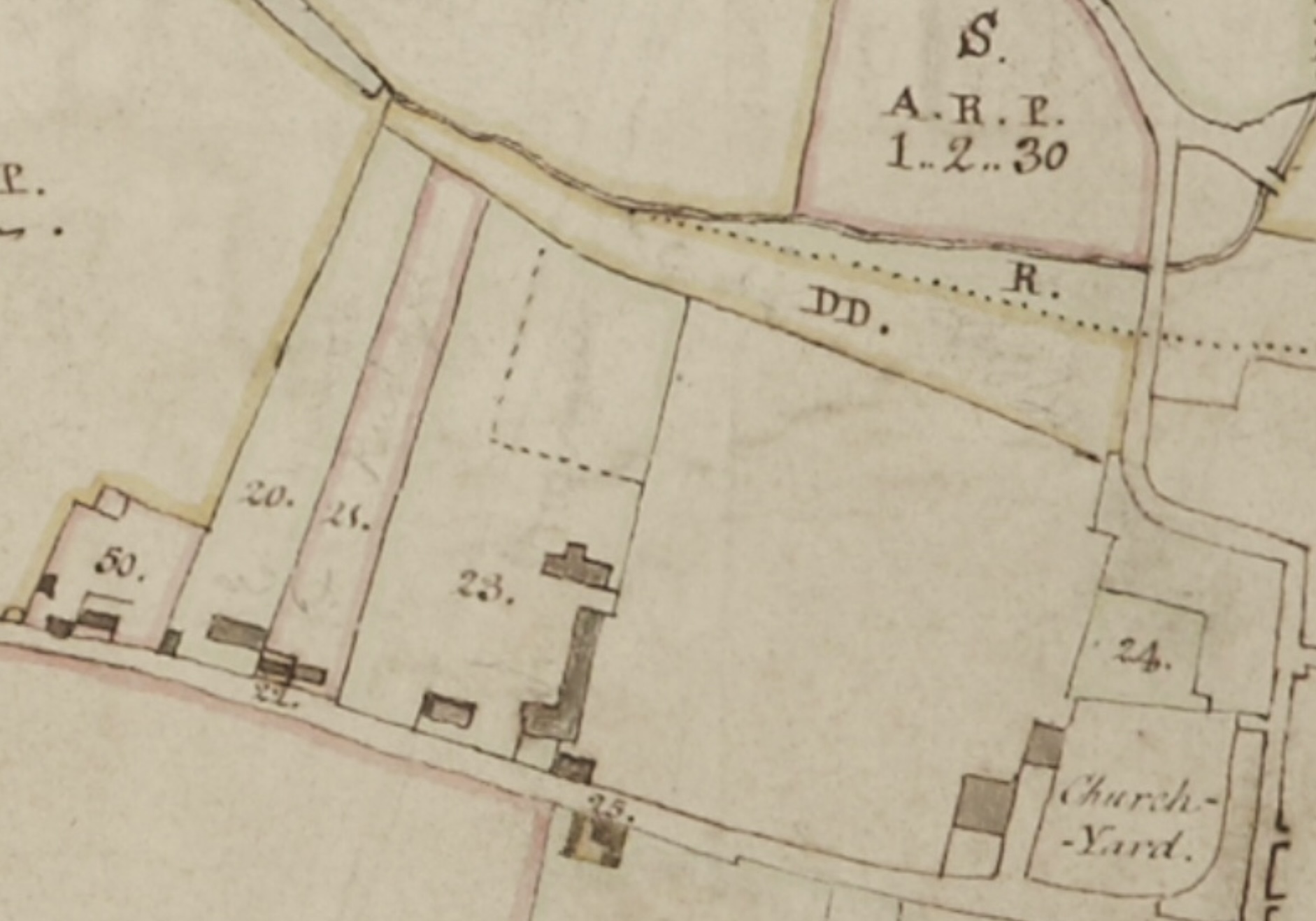
We already knew of a parcel of land called ‘Bures and Cross Keys’ which was shown on the 1799 Survey Map of Wivenhoe (Parcel 23). It was described as being of two acres and five perches in size and when compared to a modern map seems to approximately cover the length of the present day Queens Road down towards the Brook but approximately three times the width including the parcel of land now containing the White House and No 76 High Street.
The earliest deeds which refer to the Cross Keys parcel were located in the Essex Record Office (D/DEl T229) dated 1752-1820. They comment that it was formerly part of an estate called Angiers. Prior to 1801 the property was owned by John Bawtree of Colchester who is described variously in the1780s and 1790s as a ‘brewer, maltster and farmer’ and we now know that this parcel was actually the former site of two Maltings..
You can see three buildings on the parcel and it is possible that the Tavern itself was situated at the High Street end near to what is now the Greyhound where part of the converted maltings (Nos 2, 4, and 6 Queens Road) still stands see.
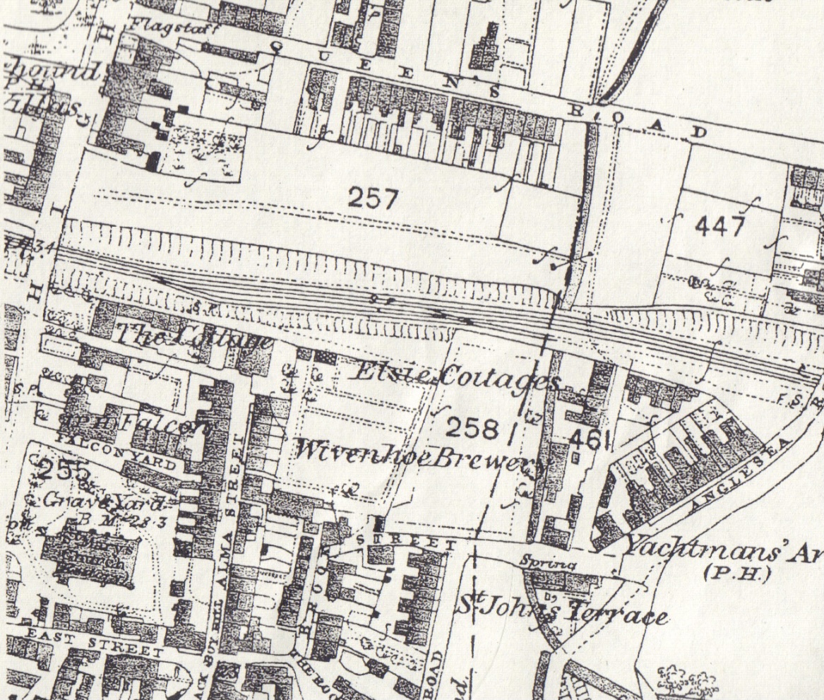
Below this was a large squarish unnamed parcel of land which we later identified after transcribing a number of local deeds as the former estate called ‘the Undersett to the Cross Keys Tavern otherwise Rogers and Saxabies’. This ran down the East side of the High Street (below Queens Road) towards the Falcon and the Church and that parcel of land which would later become known as East Street.
On 27 April 1791 John Thomas acquired part of this estate from Redhead Barnabas Barker a cordwainer from St Osyth referring to it also by its other name of ‘Rogers and Saxabies abutting on the East upon a Messuage late of Mary Barker heretofore in the occupation of Samuel Cole and now of Benjamin Mower and West upon the messuage of Thomas Clarke’.
What Happened to the Three Properties following the demise of John Thomas in 1813?
Samuel Wade acquired all three properties from John Thomas on 7/8 January 1813. On 27 September 1832 the properties passed from Joseph Fitch and trustee to Messrs Tabrum and Parkes, Grocers of Wivenhoe and were conveyed in their turn to Philip Havens Esquire on 25 April 1866.
At this stage they were still being referred to by their original names of:
‘Old Hall, messuage or tenement formerly divided into several tenements rentaries parcel of a messuage formerly called Old Hall with the yards gardens outhouses hereditaments and appurtenances thereunto belonging’
‘All that messuage or tenement being part of the Estate called the Undersett to the Cross Keys Tavern otherwise Rogers and Saxabies abutting East upon a messuage formerly of Mary Barker and West upon a messuage formerly of Thomas Clarke situate in Wivenhoe aforesaid’
‘All that messuage or tenement with the yards gardens hereditaments and appurtenances there unto belonging now or heretofore called Cold Hall also situate and being in Wivenhoe aforesaid as all the said messuages or tenements hereditaments and premises were formerly part of the Estate of John Thomas and were formerly in the tenure or occupation of John Thomas his tenants or assigns then of Augustus Le Neve then Abraham Ham David Durrell John Woodward Thomas Cole and William Powell then of the said Robert Wayland Tabrum and James Parkes their undertenants or assigns and are now or late were in the tenure or occupation of the said Edward Parkes and William Moseley Tabrum.
One year after the sale to Philip Havens it seems that the Undersett to the Cross Keys Tavern must have been disposed of as we hear that Kezia Hines was admitted to the property at a General Court Baron held on 24 April 1867 on the death of her husband William Hines.
Twenty years later in a deed of 20 April 1886 relating to the Admission of George Sachs to property relating to the North side of East Street (see download below) we hear that at a General Court Baron held for this Manor on the twenty fourth day of April One thousand eight hundred and sixty seven Kezia Hines of Wivenhoe in the County of Essex Widow was admitted upon the death and under the Will of her late Husband William Hines
All that messuage or tenement in the occupation of William Stewardson situate on the North side of the street leading from Anchor Hill to the Brook in Wivenhoe being part of the Estate called the Undersett to the Cross Keys Tavern otherwise Rogers and Saxabies abutting East upon a messuage formerly of Edward Brocket and afterwards of John Sanford and West upon a messuage formerly of Elizabeth Munkin afterwards of Mary Barker and then of the same William Hines and in the occupation of Thomas Pretty
Where Were the Properties Located?
Although we knew approximately where these properties were located it was difficult to be more precise. As an additional resource we explored some of the eighteenth century and older properties listed on the Historic England website.
We know where the Undersett to the Cross Keys Tavern (also known as Rogers and Saxabies) was located because it is shown on the 1799 Survey Map. But we don’t know which part of the parcel was acquired by John Thomas in 1791 and haven’t yet been able to locate the Messuage referred to on the east of the parcel (see above) but there are two Grade II listed candidates for the Messuage to the west of the property either of which could be the one referred to.
One is what is now 56 High Street [List Entry Number:1225322]. An C18 building which has a timber frame and render, a gambrel roof and concrete tiles. There are two flat dormers to the street with small-paned casements. The door is plain in a moulded case and there are a flat pair of small-paned sashes left and right. There is a corbelled bay, a conoid roof, and small-paned sashes on the right.
The other house which is older is 58 High Street [List Entry Number:1225323] thought to be C16 or earlier. The wing is timber framed and roughcast, there are two storeys and attics set behind a one storey modern shop. The roof ridge and gables are machine-tiled. There is a casement in the gable, and a pair of small-paned sashes on the first over shop apex to the west.
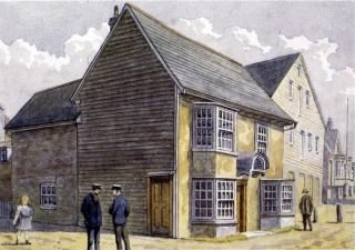
We haven’t yet been able to identify the precise location of Old Hall or Cold Hall other than that they we believe they were both situated on West Street shown running west from the Church on the 1838 Tithe Award Map. We suspect that they were sited on the north side of West Street but only one longish building appears on the north side of West Street and the junction with the High Street on the Chapman and Andre Map of 1777. A house still exists on this site and is an Historic England Grade II listed building [List Entry Number: 1225236] dating from the sixteenth century (now known as No 29 West Street) and called Old House. However the building has been complicated by being re-fronted and partly encased in the nineteenth century by what became 31 West Street and 7-9 High Street. Could this have once been the Old Hall?
One property named Cold Hall is shown on the Chapman and Andre Map to the north west of Elmstead Market. The 1799 Survey Map does include parts of the Manors of Cockaynes, Keelars and Rebandishyde but this Cold Hall is not listed and we don’t think this is the building referred to because the deeds we have transcribed specifically state that it was situated in Wivenhoe.
There are a number of other Grade II listed buildings on the Historic England site which are sited on West Street which may be contenders for either Old Hall and/or Cold Hall.
One of the most promising is West House [List Entry Number:1225343] a seventeenth to eighteenth century timber framed and plastered house on the north side of West Street which was altered in the early nineteenth century with a ridged gabled and peg tiled roof.
Another possibility is No 25 West Street [List Entry Number:1225345] dated circa 1800. It has two bays and two plastered storeys. The roof is hipped and slated with a central red brick chimney stack and eaves. There are two paned sashes on the first storey and a former shop window on the ground storey to the west, with a moulded wooden surround and a small paned sash to the right. The fact that it has a former shop window is interesting because in a later deed (as referred to above) Cold Hall was owned by William Moseley Tabrum and Edward Parkes who ran a grocery business. Could this be the same house?
The houses may of course have been demolished long ago. We know for example that a large house known as ‘West End Mansion’ in West Street was pulled down towards the end of the nineteenth century. It was close to the river and the railway station and all the materials were being put up for sale on 20 February 1893.
Trying to unravel these documents and locations has been a bit of a roller coaster although we have made some headway in exploring the lower east and west sides of the eighteenth century High Street before the wave of nineteenth century flooded the town in the nineteenth century. Further investigations of deeds by researchers and of the buildings themselves by historic building experts may be required to reveal more detailed information in the future.
Other Deeds which Refer to These Properties
North Side of East Street 1867-1965
Notes
1) Sabbatarianism was a doctrine of those Christians who believe that the Sabbath (usually on Sundays) should be observed in accordance with the Fourth Commandment, which forbids work on the Sabbath because it is a holy day (see Ten Commandments).’The Seventh-day Men’ was a title given by contemporaries in the seventeenth and eighteenth centuries to an emerging body of Christians who observed Saturday, rather than Sunday, as the divinely appointed day of rest and worship. See: Ball, Bryan W., ‘The Seventh-Day Men: Sabbatarians and Sabbatarianism in England and Wales, 1600–1800’, ISBN: 9780227173114, 470pp, November 2009
2) In English Society the terms Yeoman and Husbandman were widely used without being clearly defined, largely because contemporaries relied upon the community to judge the status of a particular individual. Legally, a yeoman was a freeholder who could meet the qualifications for voting in Parliamentary elections, but the term was evidently used much more widely probably to most freeholders, copyholders, and even tenant farmers. Thus, in a society notable for its concern with rank and social order Yeoman was a clearly recognised term applying to a rural, agricultural group below the gentry and, in some regions, above the husbandman. See ‘The Peasant in England: A Case of Terminological Confusion?’ by J. V. Beckett, The Agricultural History Review, Vol. 32, No. 2 (1984), pp. 113-123 (11 pages). Published By: British Agricultural History Society


No Comments
Add a comment about this page